
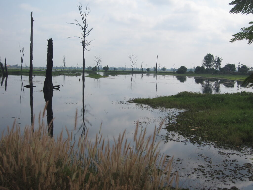
Oddar Meanchey is Cambodia’s far north, where the plains rise to the Dangrek Mountains along the border with Thailand. Its capital is Samraong. Few travellers come here, and those who do usually come to understand recent history.
Conditions now
Oddar Meanchey
27°C
Clear · feels like 34°C
- Humidity 84%
- Wind 1 km/h
- Air: Good (AQI 40)
- TodayDrizzle33° / 25°38% rain
- TueDrizzle32° / 24°49% rain
- WedDrizzle32° / 24°79% rain
- ThuDrizzle31° / 25°88% rain
- FriShowers31° / 25°73% rain
Updated hourly. Forecast and air quality by Open-Meteo.com (CC BY 4.0). Conditions can change quickly in the wet season.
Why go to Oddar Meanchey?
Come to learn. Anlong Veng was the last stronghold of the Khmer Rouge, and sites linked to that period remain. The province is also known for community forests, including what has been described as Asia’s first community-based REDD+ forest carbon project.
What to experience
Anlong Veng
Ta Mok’s house and other sites in Anlong Veng tell the story of the Khmer Rouge’s final years. Visit them as places of history and memory, not spectacle. A knowledgeable local guide gives essential context, and our guide to being a welcome guest covers visiting difficult-history sites with care.
The Dangrek escarpment
The mountains along the northern border give wide views over the forest and plains below.
Community forests
Local communities protect large areas of forest here. Ask in Siem Reap or Samraong whether any community tourism is operating before you go.
How long should you stay?
Anlong Veng can be a long day trip from Siem Reap. One night allows a slower visit.
Getting to Oddar Meanchey
Anlong Veng is roughly 125 km north of Siem Reap town, and most visitors reach it with a hired driver. Sites linked to the Khmer Rouge’s final years include Ta Mok’s house and the cremation site associated with Pol Pot, about 13 km from the Anlong Veng roundabout on National Road 67, near the Thai border. Visit these as places of history and memory, ideally with a knowledgeable local guide.
How to get there
- Arrange your transport Ask your accommodation, a licensed guide or a local driver to arrange this.
- From Siem Reap (about 125 km) Anlong Veng is roughly 125 km north of Siem Reap town, and most visitors reach it with a hired driver.
- Near the Thai border The Khmer Rouge-era sites lie close to the border. Check the current status of any Thai crossing before planning onward travel.
Ask your accommodation, a licensed guide or a local driver to arrange this. Cambodia Handbook is independent and not sponsored. Schedules change, so check the operator’s official website or office before you travel. Last checked 19 October 2026. See also transport booking and getting around Cambodia.
Planning notes
- Getting there: hire a driver from Siem Reap; public transport is limited.
- Border areas: check your government’s travel advice for areas near the Thai border before you go, and follow local guidance.
- Landmines: stay on well-used roads and paths in rural and border areas.
- Thai border: the land border with Thailand has been closed or heavily restricted since June 2025 after clashes. Check your government’s travel advice and official announcements before planning any overland route, and do not assume a crossing is open.
Oddar Meanchey FAQ
How far is Anlong Veng from Siem Reap?
Roughly 125 km to the north. It can be a long day trip, or you can stay a night.
What is there to see in Oddar Meanchey?
Sites in Anlong Veng linked to the last years of the Khmer Rouge, the Dangrek escarpment along the Thai border and community forests.
Is it safe to visit the border area?
Stay on well-used roads and paths, because the area was heavily mined, and check your government’s travel advice for the Thai border region before you go.
Can you cross into Thailand here?
The land border with Thailand has been closed or heavily restricted since June 2025. Check official announcements before relying on any crossing.
Nearby provinces
Continue into a neighbouring province. See all 25 on our provinces of Cambodia page.
Sources: geography, Anlong Veng and community forests from Oddar Meanchey province (Wikipedia). Distances from travel sources. Last checked 4 October 2026.
Photos wanted. Have you been to Oddar Meanchey recently? We would love a recent, wide photo taken in 2023 or later. Offer a photo.
Featured image: The lake at Anlong Veng, by User:Travelpleb on Wikitravel, licensed under CC BY-SA 3.0, via Wikimedia Commons.